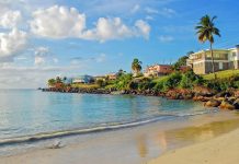
Bangladesh as a vacation land has many facets. Her tourist attractions include archaeological sites, historic mosques and monuments, resorts, beaches, picnic spots, forest and wildlife. Bangladesh offers opportunities for angling, water-skiing, river cruising, hiking, rowing, surfing, yachting and sea-bathing as well as bringing one in close touch with mother nature. She is also rich in wildlife and game birds.
Bangladesh is situated in the north-eastern part of south Asia. It lies between 20°34′ and 26°36′ north latitude and 88°1′ and 92°41′ east longitude. The heary and great Himalayas stand as the northern ramparts, while the southern frontier is guarded by the Bay of Bengal. On the west lies the expansive gangetic plains (West Bengal) of India and on the eastern frontier lies the almost impassable forest of Myanmar (Arakan Province) and India (Tripura and Assam hills). These picturesque geographical boundaries delineate out a low lying plain of about 144,000 sq.km. (55,598 sq. miles) criss-crossed by innumerable brooks, rivers, rivulets and streams. Mighty rivers the Padma, Jamuna, Meghna, Karnaphuli and others flow through Bangladesh.The unscalable blue is streched high above, and the green and silvery landscape below runs far and beyond. This is Bangladesh, a fertile land where nature is bounteous.
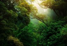
Bangladesh is a deltaic region. Much of the country’s land area has been built up from alluvial deposits brought down by the major rivers. The land is mostly flat except for a range of hills in the south-east. It is mainly characterized by wooded marshs lands and jungles with forests regions in Sylhet, Rangamati, Khagrachari and Bandarban Hill Tracts, Sundarbans, Mymensingh and Tangail
123 MILLION people live in Bangladesh, a country no bigger than the state of Iowa, which makes it one of the heavily populated countries in the world. Bangladesh occupies the delta where the Ganges and Brahmaputra Rivers, and their tributaries, drain into the Bay of Bengal. The soggy environment creates usable land, but silt-laden, unstable land that is susceptible to Bangladesh’s seasonal monsoons and floods. Bangladesh was named East Pakistan until 1971, when an India-backed East Pakistani government declared, and won, independence after a brief war. Since then, it has endured two presidential assassinations, three coups and 18 failed coup attempts.
Bangladesh is a developing economy. Tourist facilities outside major cities and tourist areas are minimal. The capital is Dhaka.
Official Name
The People’s Republic Of Bangladesh
Location
Latitude between 20 degree 34′ and 26 degree 39′ north. Longitude between 88 degree 00′ and 92 degree 41′ east.
Area
144,000 sq. km.
Boundary
Bounded by India from the north, east and west and by the Bay of Bengal and Burma from the south.
Climate
Main seasons : Winter (Nov – Feb), Summer (Mar – Jun), Monsoon (Jul – Oct). Temp : Max 34 degree Celsius, Min 8 degree Celsius.
Rainfall
Lowest 47″ and highest 136″
Capital
Dhaka (Present area 414 sq. km. Master plan 777 sq.km.)
Population
Total estimated population 130 million.
State Language
Bangla. English is also widely spoken and understood
Bangladesh has an area of about 144,000 sq km,.Bangladesh is situated between latitudes 20~34′ and 26~38′ north and latitudes 88~01′ and 92~41′ east. The country is bordered by India on the east, west and north and by the Bay of Bengal on the south. There is also a small strip of frontier with Burma on the southeastern edge. The land is a deltaic plain with a network of numerous rivers and canals.
ENTRY REQUIREMENTS: A passport and onward/return ticket are required. A visa is not required for a tourist stay of up to 15 days.

