After a report from Conservation International in 1990, that recognized Bolivia’s most diverse, humid forest in the Madidi region, the government of this Andean country hired a team of experts in 1992 to establish the borders of a future National Park that was officially declared as such on Sept. 21, 1995 through the Supreme Decree 24123. With a surface area of 18,957 sq. km. (11,848 sq. mi), it is found between the Franz Tamayo and Iturralde Provinces, to the north of the La Paz district.
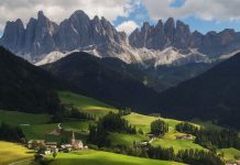
It touches other National Parks like the Manuripi Heat, the Natural Area of Apolobamba Integrated Management, and the Pilón Lajas Biosphere Reserve. It is bordered to the west by the Peruvian frontier and it stretches towards the east through the peaks of the Andes mountain range that dig into the Amazon region. It is recorded by National Geographic as one of the world’s most immense biologically diverse reserves. One of Bolivia’s richest forests, with its tropical and humid climate, is found in this National Park. There are about 988 species registered as well, although its numeration has not been completed.
The Andean region of the Park is split up by a multitude of rivers that are born in the crests of the mountain range and flow through the area in a general west to east direction. The Madidi and Tuichi rivers, affluent from the Beni, are the most abundant and the main reference points when talking about the park. There are two indigenous communities that live among the park’s surroundings: the “Tacana”, originating from the north and living mostly in the mountain forest regions of Ixiamas and Tumupasa and at the foothills of the Tutumo mountainous region, and the “Quechua” people, widely spread throughout the Amazon Basin and that live along the shores of the Tuichi river and close to Apolo. Some “Araona” communities, originating from the Pando and Beni region like the Tacana, live in the lowland rainforests, in the heart of the Park, along the borders of Madidi, and total approximately 1700 inhabitants.
A sector of the indigenous population, which is found close to the Tuichi river, came to a special agreement with UNESCO and they allowed them to utilize the forest’s natural resources. The park has also been considered for the exploration and, later on, the utilization of petroleum and for the creation of a hydroelectric plant in the Beni river.
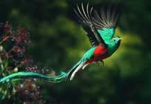
The flora and vegetation of the region is, for the most part, closely related with its varying altitudes and rugged geography. Some that are mentioned, among others, are the following types of habitats: permanent snow, Puna, cloudy forests, dry tropical forests, tropical Amazon rainforests, and savannahs or grasslands. It is estimated that 11% of all the birds in the world, a total of 1000 species, come together in these spots. Also common in this zone is a sizeable amount of mammals, rare or difficult to see in other mountainous or Amazon areas, such as the jaguar (Felis pardalis), Spectacled bear (Tremarctos ornatus), the tapir or danta (Tapirus terrestris), or other species of primates.
Studies carried out in the outskirts of Rurrenabaque and in the mountain forests of the Pilon de Lajas Reserve to the southeast of the park, or publications about the Tambopata Reserve in Peru, to the northwest of the Park, allow for an estimation of more than 5000 species of vascular plants in the Park. Of the 5000, there are about 800 of moss and liverwort, and there is an incalculable number of mushrooms and fungi due to the total absence of data for this Park region.

